Two Rivers
- Nearest town
- Eminence, MO · 5.1 mi
- Elevation
- 627 ft
- Coordinates
- 37.19389, -91.28278
About this place
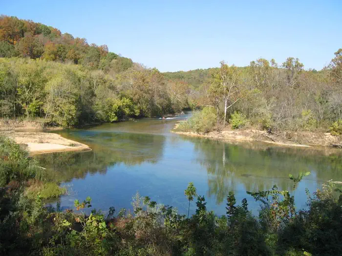
In the rolling, forested landscape of Two Rivers, two of America's most beautiful spring-fed rivers combine to make up the Ozark National Scenic Riverways.
As the first national park area to protect a wild river system, visitors have plenty of scenic water activities to enjoy as well as hiking, horseback riding and wildlife viewing.
Recreation
The crystal clear Current River flows past the campground, offering excellent canoeing, tubing, swimming, and fishing. Jacks Fork meets the Current River nearby. Over 130 miles (209 km) of waterways exist within the park. Find canoe and kayak rentals through our list of Riverways Outfitters on the park website.
Several miles of hiking and horseback riding trails crisscross the region, including the Alley Overlook Trail, Chubb Hollow Trail, Ozark Trail, Cave Spring Trail, and Big Springs Trail.
Facilities
Open year-round, this campground has flush toilets and shower facilities available April 15 through October 15. Picnic tables, campfire rings, and grills are provided. Roads and parking spurs are paved.
Natural Features
Known for its caves, springs, sinkholes and losing streams, the Ozark National Scenic Riverways has over 300 identified Caves/Karst systems within its boundaries. The caves range in size from a rock overhang to almost seven miles of identified passages. Eight caves, including an open sinkhole, have been designated as outstanding natural features.
The Ozark forest is mostly white oak and Shortleaf pine, Missouri's only native pine species. Along the rivers, Sycamore, Cottonwood, River birch and maples are common. Redbud and Dogwood are also abundant, putting on a spectacular show during most spring months.
Nearby Attractions
Historic and picturesque Alley Mill and scenic Alley Spring are nearby. The mill is open daily in the summer and rangers offer tours upon request. Round Spring and Round Spring Cave are nearby as well, with ranger-guided tours offered daily during summer months.
Services
What you can do here
A dotted outline means nobody has told us either way. It is not a no — it is an honest gap, and the fastest way to close it is a traveller who has been there.
Rates
What it costs
Peak season, April 15, 2026 to October 15, 2026. Outside those dates the site may be closed or priced differently.
| Site type | Per night |
|---|---|
| Tent Only Nonelectric | $10.00 |
| Standard Nonelectric | $20.00 |
| Group Standard Nonelectric | $45.00 |
Recreation.gov booking system · read Aug 19, 2026. Fees change; the booking page is authoritative.
The details, and where each came from
Everything we know
- ADA accessible
- No
- Back-in spaces
- 5
- Campfires allowed
- Yes
- Longest rig that fits (ft)
- 28
- Number of campsites
- 22
- Pets allowed
- Yes
- Phone number
- (573) 323-4236
- Reservable
- Yes
- Water hookup at site
- No
If this one is closed
Other dump stations nearby
| Location | Distance | Confidence |
|---|---|---|
| RV Dump Station | 9.2 mi | Limited confidence |
| RV Dump Station | 9.6 mi | Limited confidence |
| RV Dump Station | 11 mi | Limited confidence |
| Webb Creek Park | 26 mi | Limited confidence |
| Bluff View(clearwater Lake) | 27 mi | Limited confidence |
Photos
What it looks like
Last updated Aug 19, 2026.