Frank Russell
- Nearest town
- Center, MO · 6.6 mi
- Elevation
- 696 ft
- Coordinates
- 39.53556, -91.64750
About this place
Frank Russell Campground offers spacious campsites and convenient access to a variety of recreation opportunities. Visitors can enjoy playgrounds, a designated fishing pond, scenic shoreline trails, a bike trail, and a multipurpose equestrian trail with a designated equestrian camping area and horse corral. The Archery Park features a static range, an elevated 3D target course, and a fitness trail with integrated archery shooting lanes. For boating and swimming, Spalding Recreation Area, featuring a boat ramp and swimming beach, is located just 4 miles north on Highway J.
Recreation
Frank Russell Campground offers spacious campsites and convenient access to a variety of recreation opportunities. Visitors can enjoy playgrounds, a designated fishing pond, scenic shoreline trails, a bike trail, and a multipurpose equestrian trail with a designated equestrian camping area and horse corral. The Archery Park features a static range, an elevated 3D target course, and a fitness trail with integrated archery shooting lanes. For boating and swimming, Spalding Recreation Area, featuring a boat ramp and swimming beach, is located just 4 miles north on Highway J.
Facilities
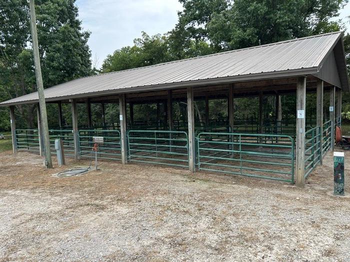
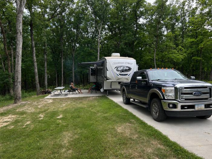
Adjacent to the campground, equestrian campers can make use of the shaded horse stalls. Campsites are equipped with electric hookups, paved parking, grills and picnic tables. Other amenities include showers, playgrounds and vault toilets.
Natural Features
Mark Twain Lake is sourced by the Salt River in northeast Missouri. The Clarence Cannon Dam sits on the eastern edge of the lake, providing flood control and hydroelectricity to the region.
Nearby Attractions
While here, many visitors tour the birthplace of world-famous humorist and author, Mark Twain, in Florida, Missouri.
The David C. Berti Shooting Range is below the dam and the M.W. Boudreaux Visitor Center is located on the south end of the Dam.
Services
What you can do here
A dotted outline means nobody has told us either way. It is not a no — it is an honest gap, and the fastest way to close it is a traveller who has been there.
Rates
What it costs
Peak season, April 3, 2026 to November 22, 2026. Outside those dates the site may be closed or priced differently.
| Site type | Per night |
|---|---|
| Equestrian Electric | $24.00 |
| Standard Electric | $24.00 |
| Group Shelter Electric | $30.00 |
Recreation.gov booking system · read Aug 19, 2026. Fees change; the booking page is authoritative.
The details, and where each came from
Everything we know
- ADA accessible
- No
- Back-in spaces
- 72
- Campfires allowed
- Yes
- Electric hookup (amps)
- 50
- Fresh tank fill
- Yes
- Longest rig that fits (ft)
- 88
- Number of campsites
- 72
- Pets allowed
- Yes
- Phone number
- (573) 735-4097
- Potable water
- Yes
- Reservable
- Yes
- Water hookup at site
- Yes
If this one is closed
Other dump stations nearby
| Location | Distance | Confidence |
|---|---|---|
| RV Dump Station | 2.0 mi | Limited confidence |
| RV Dump Station | 9.4 mi | Limited confidence |
| Hickory Ridge Campground | 44 mi | Limited confidence |
| RV Dump Station | 44 mi | Limited confidence |
| RV Dump Station | 50 mi | Limited confidence |
Photos
What it looks like
Last updated Aug 19, 2026.